August 3, 2023

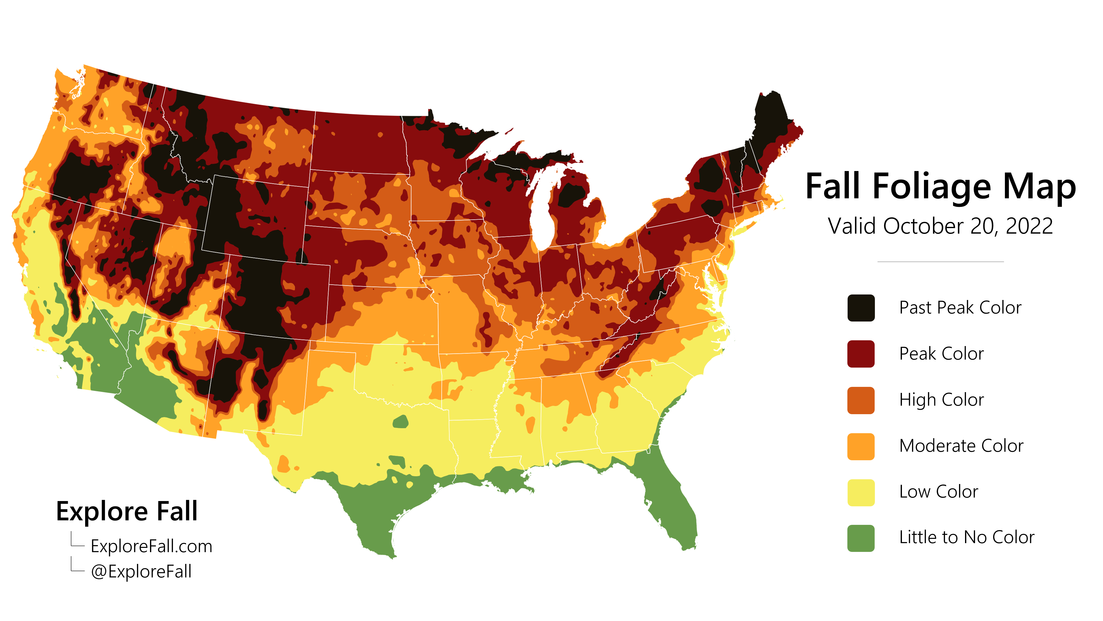
We upload new fall foliage KMLs to an open access Google Drive folder every Monday and Thursday throughout the fall (and some odd days in between). Each KML package contains two files: one with the current progression of fall foliage throughout the United States, and another with our seven-day fall foliage forecast.
Each KML is generated using our state of the art in-house fall foliage model and checked against a network of real-time observations, so you can trust that you're getting the most accurate portrayal of fall foliage on the market. We don't charge for use of our files, however, we do require that credit to Explore Fall be included in all publications that include our KMLs. See below for ways to credit Explore Fall:
We trust that our KML users are honorable and will provide proper credit according to these guidelines. We are not particularly picky when it comes to how verbal or written attribution is given; however, Explore Fall reserves the right to remove anyone from our email list who fails to provide attribution.
Every time we craft a new KML, we first consider the output of our in-house fall foliage model. Though not perfect, it provides us with a solid framework for drawing up areas of fall color throughout the US. From there, we cross-reference our model with recent satellite and webcam imagery and adjust accordingly. This provides an invaluable dataset of fall foliage observations to support any necessary changes to our raw, model-based KML.
Finally, public reports fill in the gaps for areas in which we have no satellite or webcam imagery. With all of these datasets considered, we craft a KML that is perfectly suited for regional mapping and travel recommendations. It should be noted that unlike our fall foliage model, the KMLs do not portray small-scale topography. As such, mountainous areas should be aware that fall color will vary from valley to mountaintop and may not be accounted for in the KML.
The inner workings of our in-house fall foliage model allow us to process real-time weather model data and generate fall foliage forecasts accordingly. For consistency reasons, we rely upon the National Blend of Models (NBM) for our weather data and limit forecast KMLs to seven days. This provides KML users with a snapshot of vibrant fall foliage will be in one week, without compromising our commitment to accurate maps.
Similar to the real-time KMLs, we hand draw our forecast KMLs by considering model output, with necessary changes made to correct inaccuracies in model inialization. We guarantee you won't find a more consistent, meticulous, and accurate set of fall foliage data anywhere else on the Internet!
Millions of people travel to see fall foliage annually, making it one of the most lucrative tourism periods of the year. KMLs provide businesses and individuals with the means of creating informative fall foliage maps with minimal GIS skills. Our files are pre-styled, so there's no need to spend hours learning how to change the colors of your map. Instead, simply drop the KML into your GIS software of choice and it automatically looks professional!
Other file formats can be cumbersome and more difficult to understand for new cartographers. If you make TV graphics, you likely already know that KMLs are the industry standard! We strive for ease of use in all of our products, and these KMLs are no exception. Should you have any questions or issues pertaining to our KML products, don't hesitate to reach out via email at evan@explorefall.com.