

Maryland Fall Foliage Map 2026
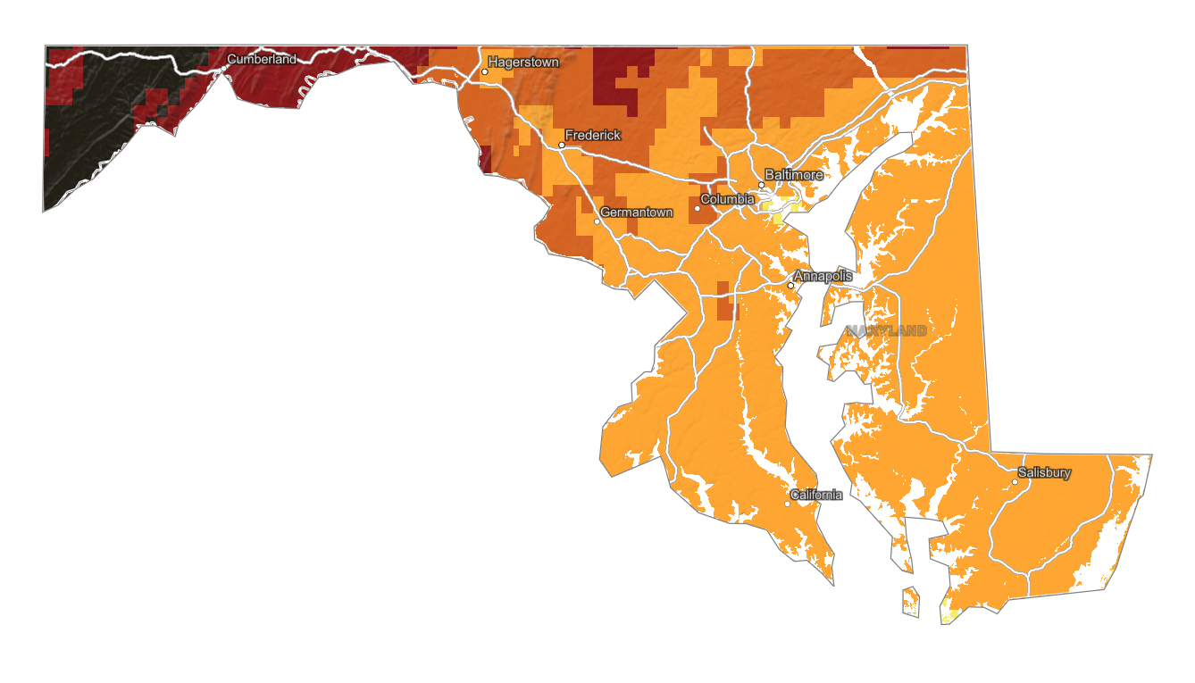
We're once again helping fall foliage enthusiasts in Maryland find the best fall color! Search a place, drag the date slider, and plan where color should be best.
Color Report
Peak Timing
Reports
Download
Little to No Color
Low Color
Moderate Color
High Color
Peak Color
Past Peak Color
Coming Fall 2026

Powered by Esri
Map Tips
- Use the Search Bar to find a Maryland city, park, scenic route, or mountain town.
- Use Color Report for daily foliage stage estimates.
- Use Peak Timing to see when each area should reach peak color.
- Toggle Reports On/Off to see or hide local color reports on the map.
- Click Download to save an image of the current map view.




Maryland Fall Color
We're once again helping fall foliage enthusiasts in Maryland find the best fall color! Use our map to explore the estimated timing of fall color throughout the state, allowing you to plan trips with confidence this year. Check back regularly for updates based on the latest reports gathered from hundreds of sources throughout the region.
Maryland’s fall foliage lights up the state with a vibrant mix of colors, as maples blaze in bright reds, oaks and hickories add warm oranges and yellows, and sycamores glow golden across its rolling hills and coastal plains. From the rugged trails of Catoctin Mountain to the serene beauty of the Chesapeake Bay region, each area offers a unique display shaped by local trees and crisp autumn air. Use our map to pinpoint the best times and spots for peak color, whether you’re hiking in Patapsco Valley State Park or driving through the Western Maryland countryside.
Finding Peak Color in Maryland
Maryland’s fall foliage lights up the state with a vibrant mix of colors, as maples blaze in bright reds, oaks and hickories add warm oranges and yellows, and sycamores glow golden across its rolling hills and coastal plains. From the rugged trails of Catoctin Mountain to the serene beauty of the Chesapeake Bay region, each area offers a unique display shaped by local trees and crisp autumn air. Use our map to pinpoint the best times and spots for peak color, whether you’re hiking in Patapsco Valley State Park or driving through the Western Maryland countryside.
Elevation, latitude, local weather, and forest composition can shift peak color by several days, so the map is most useful when paired with a specific destination forecast.