

Massachusetts Fall Foliage Map 2026
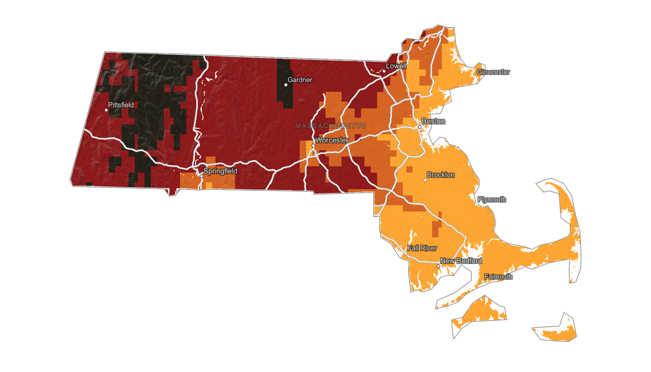
Use the Massachusetts fall foliage map to track color from the Berkshires and Pioneer Valley to central Massachusetts, Boston, and the coast. Search a place, drag the date slider, and plan where color should be best.
Color Report
Peak Timing
Reports
Download
Little to No Color
Low Color
Moderate Color
High Color
Peak Color
Past Peak Color
Coming Fall 2026

Powered by Esri
Map Tips
- Use the Search Bar to find a Massachusetts city, park, scenic route, or mountain town.
- Use Color Report for daily foliage stage estimates.
- Use Peak Timing to see when each area should reach peak color.
- Toggle Reports On/Off to see or hide local color reports on the map.
- Click Download to save an image of the current map view.




Massachusetts Fall Color
Use the Massachusetts fall foliage map to track color from the Berkshires and Pioneer Valley to central Massachusetts, Boston, and the coast. The map helps show where peak color is likely to arrive first and where lower or coastal areas may still have useful color later in the season.
The Berkshires, Mohawk Trail, Mount Greylock, Lenox, North Adams, and Shelburne Falls are classic Massachusetts foliage areas because elevation and hardwood forest coverage support strong color. Farther east, central Massachusetts, Concord, and Boston-area parks can peak later and may be better after western Massachusetts has faded.
Finding Peak Color in Massachusetts
The Berkshires, Mohawk Trail, Mount Greylock, Lenox, North Adams, and Shelburne Falls are classic Massachusetts foliage areas because elevation and hardwood forest coverage support strong color. Farther east, central Massachusetts, Concord, and Boston-area parks can peak later and may be better after western Massachusetts has faded.
Use this map to compare regional timing, then search a specific town or park with the fall foliage forecast. Massachusetts fall color can vary quickly from hilltowns to river valleys, and coastal moderation often delays color near the Atlantic.