

Minnesota Fall Foliage Map 2026
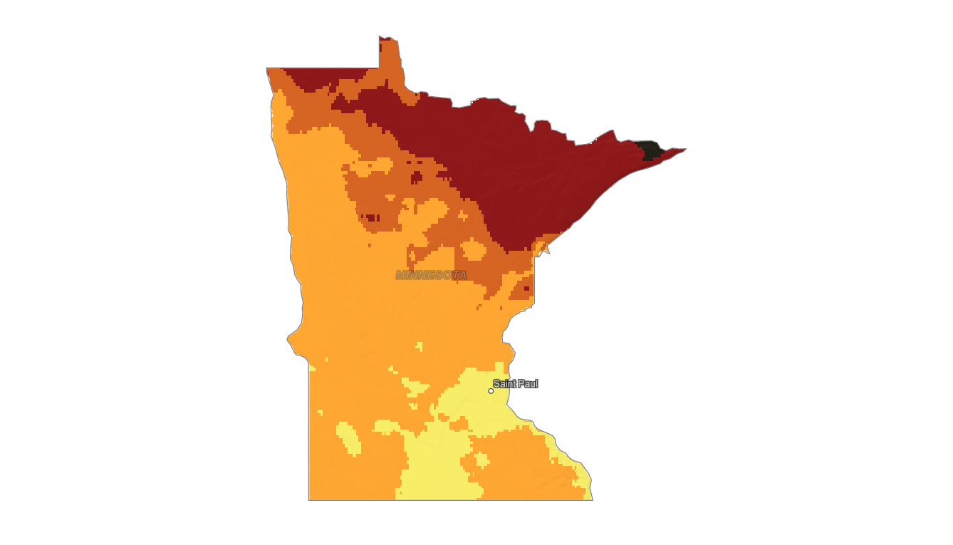
Use the Minnesota fall foliage map to compare color timing from the North Shore and Boundary Waters to central lakes, the Twin Cities, and Bluff Country. Search a place, drag the date slider, and plan where color should be best.
Color Report
Peak Timing
Reports
Download
Little to No Color
Low Color
Moderate Color
High Color
Peak Color
Past Peak Color
Coming Fall 2026

Powered by Esri
Map Tips
- Use the Search Bar to find a Minnesota city, park, scenic route, or mountain town.
- Use Color Report for daily foliage stage estimates.
- Use Peak Timing to see when each area should reach peak color.
- Toggle Reports On/Off to see or hide local color reports on the map.
- Click Download to save an image of the current map view.




Minnesota Fall Color
Use the Minnesota fall foliage map to compare color timing from the North Shore and Boundary Waters to central lakes, the Twin Cities, and Bluff Country. Northern Minnesota can change much earlier than southern river valleys, making statewide timing important for trip planning.
The North Shore near Lutsen, Grand Marais, Tettegouche, and Gooseberry Falls often delivers early maple and aspen color, while Ely, Itasca State Park, the St. Croix Valley, and southeastern bluffs can offer different timing and species mixes. Lake Superior can also shift color near the shoreline.
Finding Peak Color in Minnesota
The North Shore near Lutsen, Grand Marais, Tettegouche, and Gooseberry Falls often delivers early maple and aspen color, while Ely, Itasca State Park, the St. Croix Valley, and southeastern bluffs can offer different timing and species mixes. Lake Superior can also shift color near the shoreline.
Use this map to identify the best region, then check a specific destination with the fall foliage forecast. In Minnesota, latitude and proximity to Lake Superior can matter as much as the calendar date when deciding where to see peak fall color.