

New Hampshire Fall Foliage Map 2026
Use the New Hampshire fall foliage map to follow changing color across the White Mountains, Lakes Region, Monadnock Region, and southern valleys. Search a place, drag the date slider, and plan where color should be best.
Color Report
Peak Timing
Reports
Download
Little to No Color
Low Color
Moderate Color
High Color
Peak Color
Past Peak Color
Coming Fall 2026

Powered by Esri
Map Tips
- Use the Search Bar to find a New Hampshire city, park, scenic route, or mountain town.
- Use Color Report for daily foliage stage estimates.
- Use Peak Timing to see when each area should reach peak color.
- Toggle Reports On/Off to see or hide local color reports on the map.
- Click Download to save an image of the current map view.




New Hampshire Fall Color
Use the New Hampshire fall foliage map to follow changing color across the White Mountains, Lakes Region, Monadnock Region, and southern valleys. The map shows estimated daily foliage conditions and peak timing so you can compare where color is building, where it is near peak, and where it may already be past peak.
New Hampshire's terrain creates sharp differences over short distances. Franconia Notch, Crawford Notch, the Kancamagus Highway, Mount Washington, North Conway, and Jackson often change earlier than lower areas near Lake Winnipesaukee or the Merrimack Valley, especially when cool nights arrive in the mountains first.
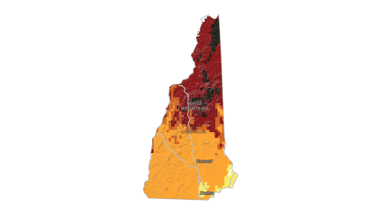
Finding Peak Color in New Hampshire
New Hampshire's terrain creates sharp differences over short distances. Franconia Notch, Crawford Notch, the Kancamagus Highway, Mount Washington, North Conway, and Jackson often change earlier than lower areas near Lake Winnipesaukee or the Merrimack Valley, especially when cool nights arrive in the mountains first.
Use this statewide map for regional timing, then search a specific destination with the fall foliage forecast before choosing a travel date. Elevation, local species mix, wind, rain, and recent cold nights can all shift the best New Hampshire fall color from one valley or overlook to the next.