

Pennsylvania Fall Foliage Map 2026
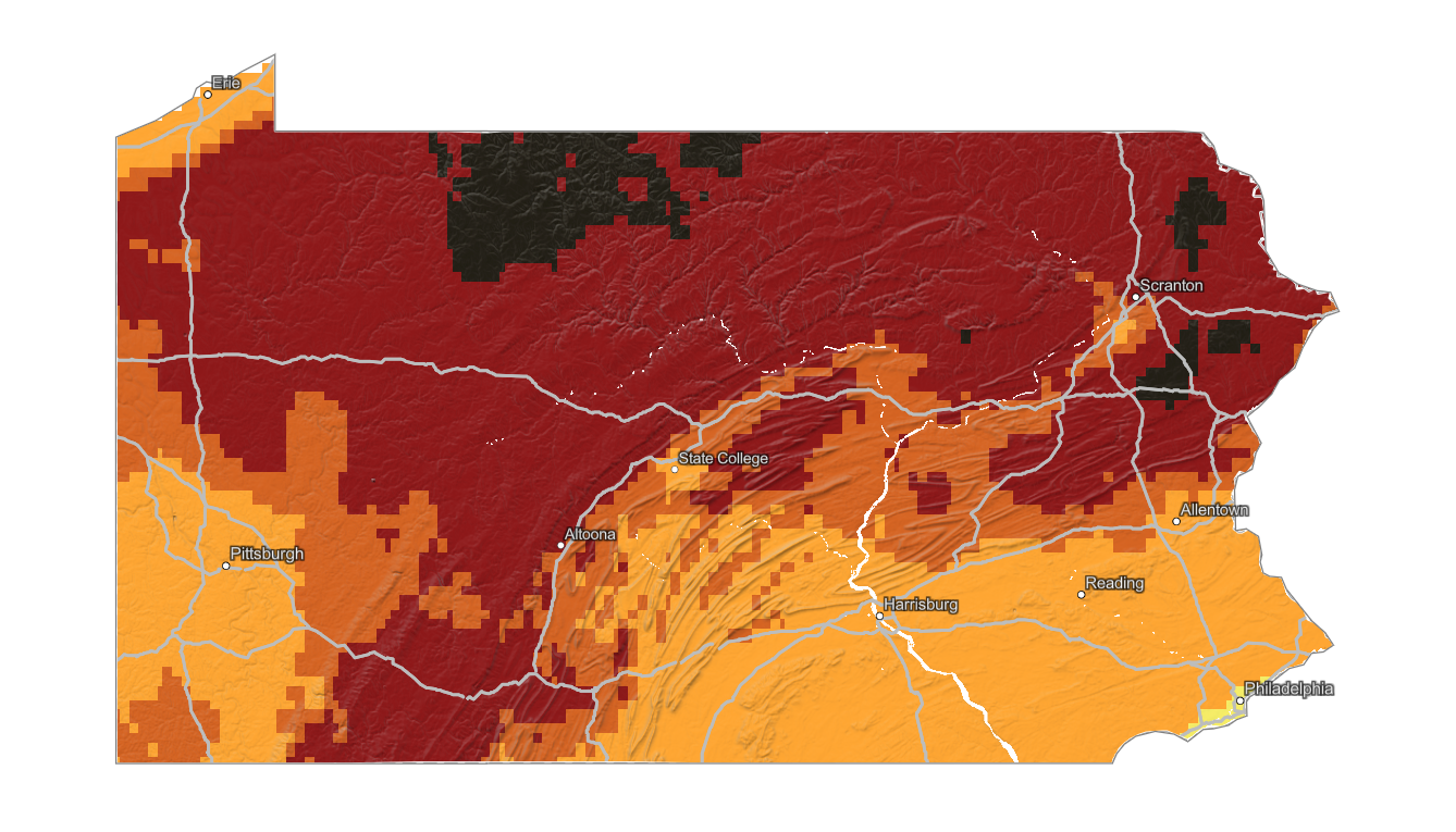
Use the Pennsylvania fall foliage map to compare color timing across the Poconos, Allegheny Plateau, Laurel Highlands, central ridges, and southeastern valleys. Search a place, drag the date slider, and plan where color should be best.
Color Report
Peak Timing
Reports
Download
Little to No Color
Low Color
Moderate Color
High Color
Peak Color
Past Peak Color
Coming Fall 2026

Powered by Esri
Map Tips
- Use the Search Bar to find a Pennsylvania city, park, scenic route, or mountain town.
- Use Color Report for daily foliage stage estimates.
- Use Peak Timing to see when each area should reach peak color.
- Toggle Reports On/Off to see or hide local color reports on the map.
- Click Download to save an image of the current map view.




Pennsylvania Fall Color
Use the Pennsylvania fall foliage map to compare color timing across the Poconos, Allegheny Plateau, Laurel Highlands, central ridges, and southeastern valleys. Pennsylvania has a large elevation range and extensive hardwood forest, so peak color can vary widely across the state.
The Poconos, Jim Thorpe, Wellsboro, Pennsylvania Grand Canyon, Cook Forest, Ohiopyle, and the Allegheny National Forest are all strong fall foliage destinations, but they do not always peak together. Northern and higher terrain often changes earlier than the Philadelphia suburbs, Lancaster County, and lower Susquehanna Valley.
Finding Peak Color in Pennsylvania
The Poconos, Jim Thorpe, Wellsboro, Pennsylvania Grand Canyon, Cook Forest, Ohiopyle, and the Allegheny National Forest are all strong fall foliage destinations, but they do not always peak together. Northern and higher terrain often changes earlier than the Philadelphia suburbs, Lancaster County, and lower Susquehanna Valley.
Use the map for statewide timing, then check a specific town, overlook, trail, or scenic drive with the fall foliage forecast. Local elevation, forest type, drought stress, wind, and recent rain can all affect how long peak Pennsylvania fall color holds.